CoastSnap State Beach MV
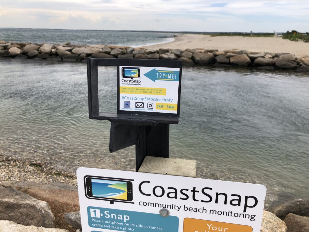
CoastSnap harnesses the power of crowdsourcing to record short- and long-term beach erosion and recovery. The station at State Beach in Oak Bluffs enables monitoring of sediment build up in the channel between Vineyard Sound and Sengekontaket Pond.
Read MoreCoastSnap Town Neck Beach

CoastSnap is a network of simple camera mounts at beaches that invite the public to take a photo and upload it to social media, using a specific hashtag. CoastSnap harnesses the power of crowdsourcing to record short- and long-term beach erosion and recovery. The station at Town Neck beach in Sandwich enables monitoring of a…
Read MoreFEMA High Water Mark Initative
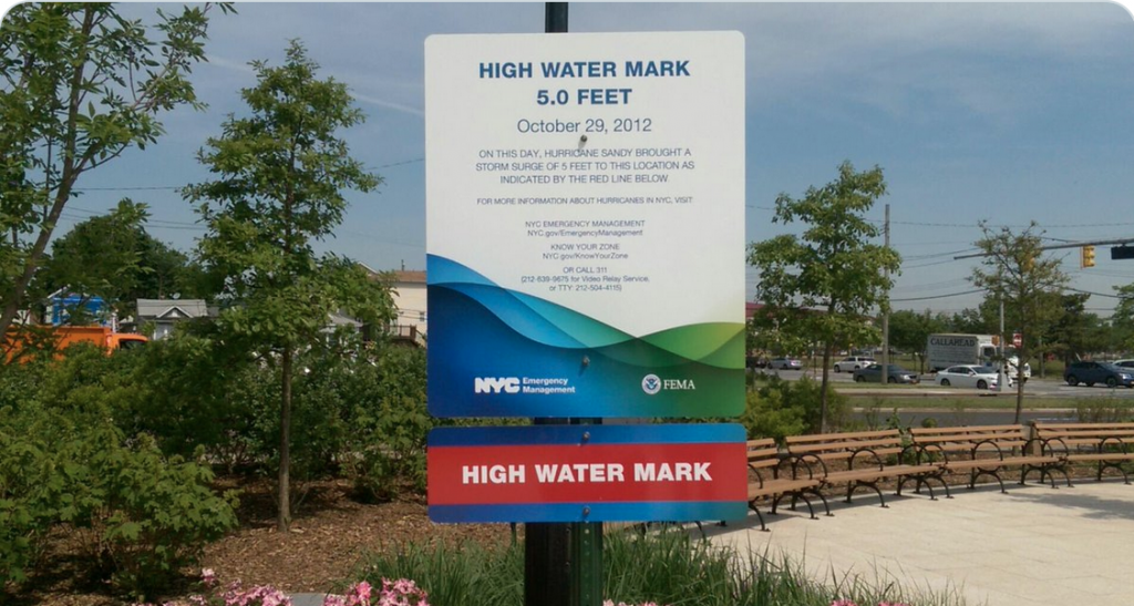
The purpose of the project is to document high water marks to show previous flooding levels. It is an educational tool that allows people to take photos of high water levels and post them on social media with a hashtag. The program was created by FEMA. Read more about the program at https://www.fema.gov/flood-maps/products-tools/high-water-mark-initiative. Thirty-seven communities…
Read MoreGhosts of the Coast
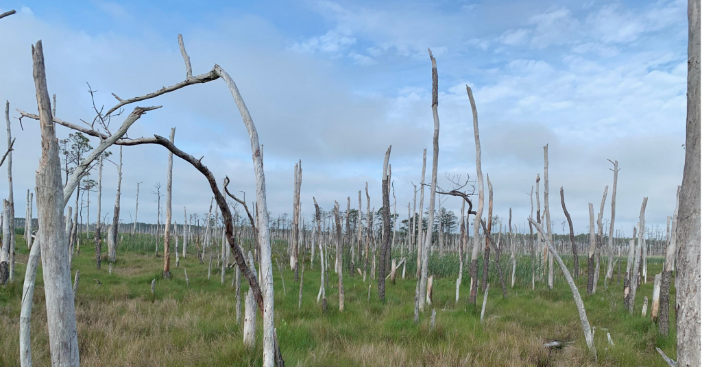
We are engaging citizen scientists to help document the formation of ghost forests on a larger scale. Their observations will help us better understand where ghost forests are being observed and what these locations have in common.
Read MoreGulf of Maine King Tides
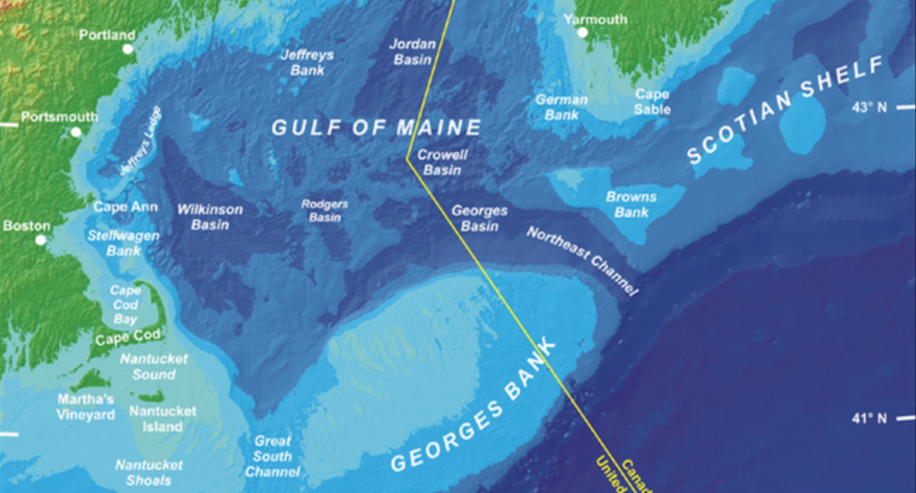
The Gulf of Maine King Tides Project helps communities in the Northeastern US and Atlantic Canada anticipate impacts from rising sea levels. Join in this international effort to document—via cameras and smart phones—extreme high tides, which will become average water levels in coming years. King Tides images help scientists and planners assess future flood risks…
Read MoreKing Tides – Massachusetts

The Massachusetts king tides initiative documents the effect that extreme tide events have on the state’s beaches, coastal waterways, private property, and public infrastructure.
Read MoreStorm Reporter – Massachusetts
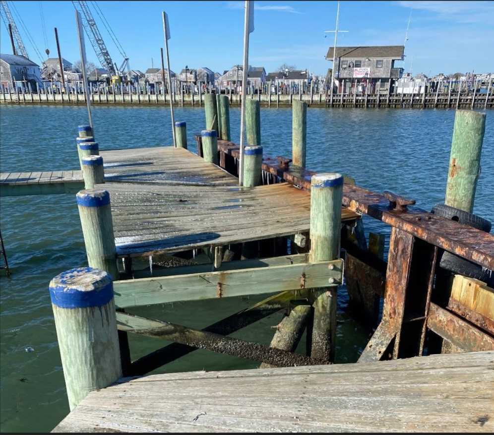
Tools used by the Massachusetts Rapid Response Coastal Storm Damage Assessment Team to promote rapid delivery and archival of coastal storm damage observations to calibrate National Weather Service erosion models.
Read More