Coastal Change
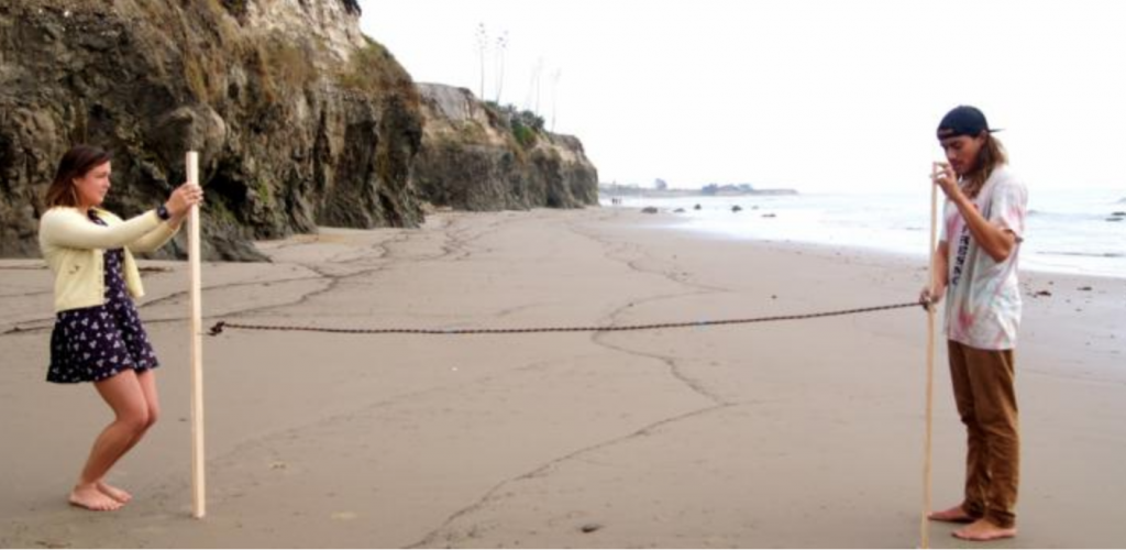
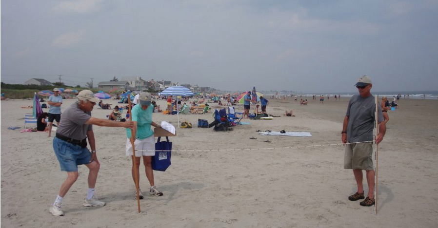
Beach Profiling in Coastal New Hampshire
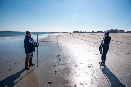
Beaches are constantly changing! Forces like storms, ocean currents, and changes in sea level work together to add and remove sand from the beach. Beach profiling is a simple way to track these changes over time. By measuring the contour, or profile, of a beach at regular monthly intervals, we can observe long-term patterns of sand…
Read MoreBristol Bay Residents Taking a Stake in Shoreline Erosion Monitoring
The project worked to increase the scientific capacity of Bristol Bay (AK) Region to collect quantitative measurements of coastal, river, and/or lake erosion to create a quantitative record of shoreline change. This project was active from 2015 – 2018.
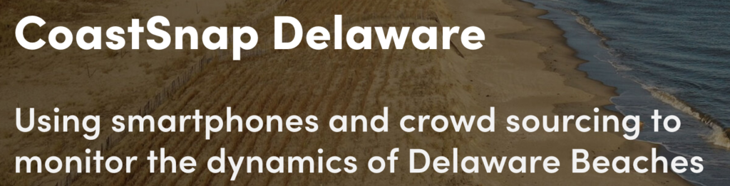
Read MoreCoastSnap Broadkill Beach

Public access to Broadkill Beach relies on dune crossovers that are vulnerable to erosion during storms due to the proximity of the dune toe to the Bay. CoastSnap contributors help environmental managers to gather “real-time” data on the condition of the beach and add to the existing datasets (optical, elevation, morphological) at this site to…
Read MoreCoastSnap Herring Point
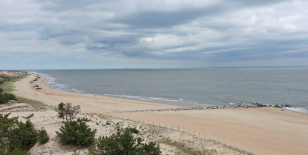
Using cellphone images submitted by passers-by, CoastSnap allows more frequent monitoring of Herring Point beach erosion, dune sediment and vegetation, and complements the semi-annual surveys collected by DNREC.
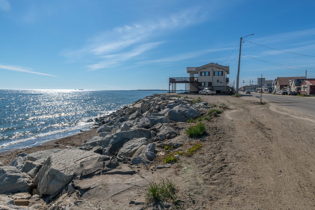
Read MoreCoastSnap Indian River Inlet
Images submitted by the public through the CoastSnap station at Indian River Inlet help DNREC monitor the sand supply and the beach conditions, enabling more informed management decisions.
Read MoreCoastSnap State Beach MV
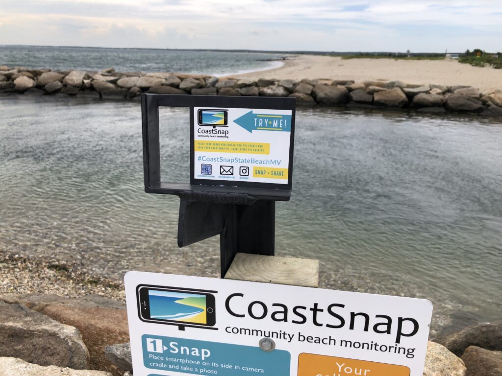
CoastSnap harnesses the power of crowdsourcing to record short- and long-term beach erosion and recovery. The station at State Beach in Oak Bluffs enables monitoring of sediment build up in the channel between Vineyard Sound and Sengekontaket Pond.
Read MoreCoastSnap Town Neck Beach

CoastSnap is a network of simple camera mounts at beaches that invite the public to take a photo and upload it to social media, using a specific hashtag. CoastSnap harnesses the power of crowdsourcing to record short- and long-term beach erosion and recovery. The station at Town Neck beach in Sandwich enables monitoring of a…
Read MoreCommunity Alliance for Surveying the Topography of Sandy Beaches (CoAST SB)
Volunteers monitor the movement of the shoreline in Santa Barbara and Ventura counties, measuring the contour of sandy beaches using a quick and simple beach profiling survey technique. The data collected is provided to USGS to help track changes and callibrate models; local governments use this information for climate adaptation planning.
Read MoreDune Restoration and Research

The project works to restore and maintain healthy dunes in New Hampshire. Volunteers plant native grasses, install sand fencing, post educational signage, and actively survey the dunes to document sand gains and losses. Volunteers are also active participants in research on dune resilience and restoration methods.
Read MoreInterdisciplinary Citizen-based Coastal REmote Sensing for Adaptive Management (IC-CREAM)

IC-CREAM Marquette. An effort to increase resilience; seeks to harness local knowledge and involvement by teaching some community members how to use drones to collect critical information for coastal change monitoring.
Read MoreInterdisciplinary Citizen-based Coastal REmote Sensing for Adaptive Management (IC-CREAM)
IC-CREAM Manistique. An effort to increase resilience; seeks to harness local knowledge and involvement by teaching some community members how to use drones to collect critical information for coastal change monitoring.
Read MoreInterdisciplinary Citizen-based Coastal REmote Sensing for Adaptive Management (IC-CREAM)
An effort to increase resilience; seeks to harness local knowledge and involvement by teaching some community members how to use drones to collect critical information for coastal change monitoring
Read MoreInterdisciplinary Citizen-based Coastal REmote Sensing for Adaptive Management (IC-CREAM)
IC-CREAM Chikaming. An effort to increase resilience; seeks to harness local knowledge and involvement by teaching some community members how to use drones to collect critical information for coastal change monitoring.
Read MoreInterdisciplinary Citizen-based Coastal REmote Sensing for Adaptive Management (IC-CREAM)
IC-CREAM Manistee. An effort to increase resilience; seeks to harness local knowledge and involvement by teaching some community members how to use drones to collect critical information for coastal change monitoring.
Read MoreInterdisciplinary Citizen-based Coastal REmote Sensing for Adaptive Management (IC-CREAM)
IC-CREAM South Haven. An effort to increase resilience; seeks to harness local knowledge and involvement by teaching some community members how to use drones to collect critical information for coastal change monitoring
Read MorePicture Post Monitoring – Hampton Falls
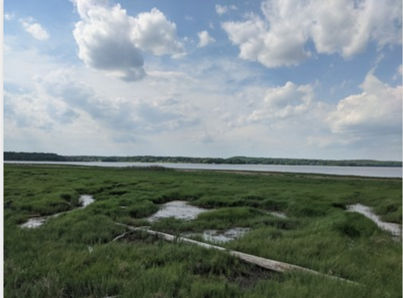
Coastal Research Volunteer (CRV) is working with local salt marsh natural areas to install Picture Posts, fixed points from which volunteers regularly take pictures. Photographs taken at these fixed locations build up a long-term record of changes over time. Our Picture Posts in Hampton Falls and Seabrook are part of a nationwide network of Picture…
Read MorePicture Post Monitoring – Seabrook

Coastal Research Volunteer (CRV) is working with local salt marsh natural areas to install Picture Posts, fixed points from which volunteers regularly take pictures. Photographs taken at these fixed locations build up a long-term record of changes over time. Our Picture Posts in Hampton Falls and Seabrook are part of a nationwide network of Picture…
Read MoreSalt Marsh Restoration
Local communities cultivate, transplant, and monitor the growth of salt marsh smooth cordgrass to restore Charleston area salt marshes.
Read MoreSouthern Maine Volunteer Beach Profile Monitoring Program – So. Portland
The Southern Maine Volunteer Beach Profile Monitoring Program is a unique collaboration among local volunteers, participating municipalities, and scientists, resulting in over 20 years of critical data on the status of one of Maine’s most vital and valuable natural resources. Data is used to inform beach management decisions; to monitor the success of management programs.
Read MoreSouthern Maine Volunteer Beach Profile Monitoring Program – York
The Southern Maine Volunteer Beach Profile Monitoring Program is a unique collaboration among local volunteers, participating municipalities, and scientists, resulting in over 20 years of critical data on the status of one of Maine’s most vital and valuable natural resources. Data is used to inform beach management decisions; to monitor the success of management programs.
Read MoreStorm Witness

South Carolina Storm Witness facilitates communication and beachfront damage assessment information among coastal municipalities and state coastal resource managers. Damage assessment information collected through the system enables DHEC to efficiently analyze post-storm beach conditions and expedite recovery activities, including permitting and other regulatory decisions.
Read MoreTake a Beach Photo – Washington
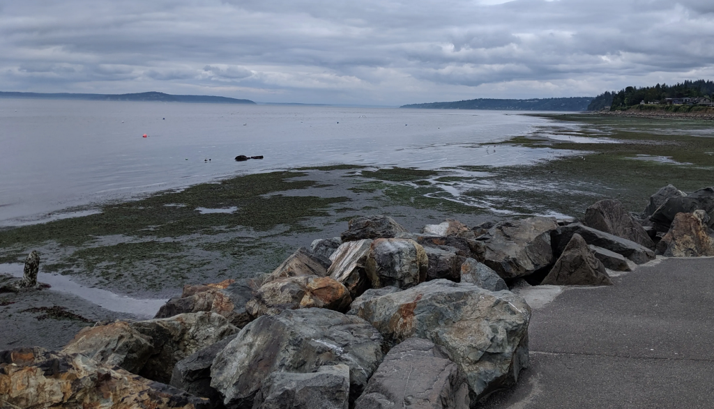
Information collected through this site is used to characterize beach change and the impact of nearshore hazards in order to enhance awareness among decision-makers and stakeholders.
Read MoreWetlands Watch

Wetlands Watch works with state and federal policy advocacy and grass roots education and activism to influence local government land use and regulatory decisions. To monitor flooding in the wetlands, the group created and uses a phone app that collects crowdsourced information about flooding and king tides. The app is available for anyone to use,…
Read More